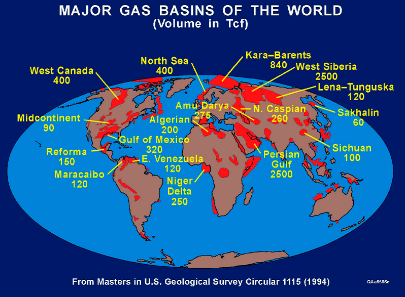
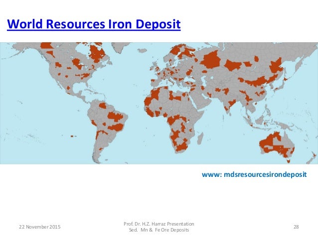
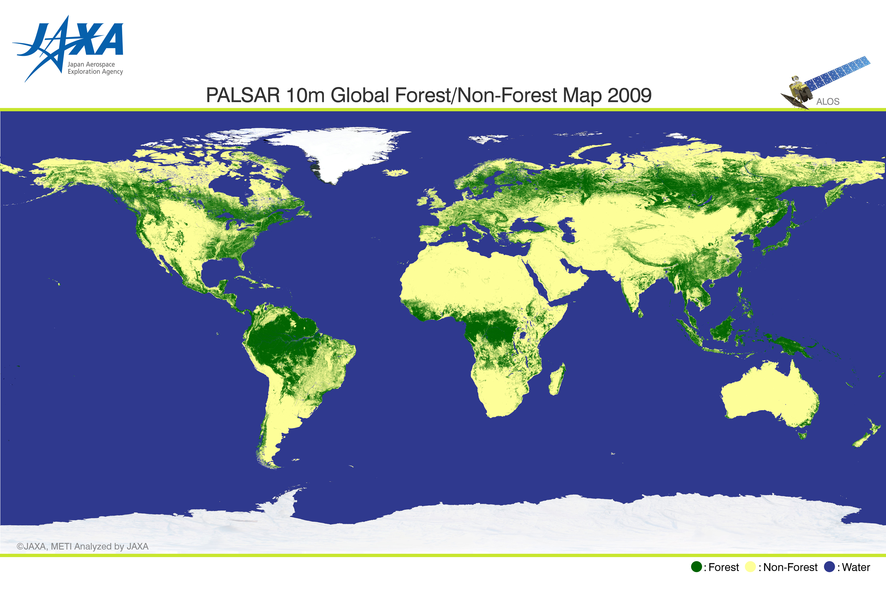
THEMATIC MAPS: Natural Resource Reserves




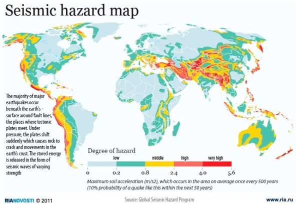
EARTHQUAKES: Use an orange colored pencil or marker to lightly shade all of the areas that face a high or very high risk of seismic (earthquake) activity.
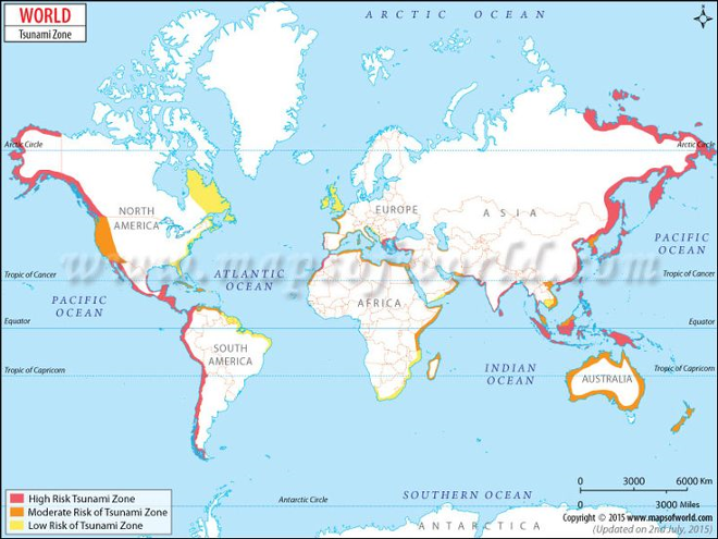
TSUNAMIS: Use blue colored pencil or marker to draw horizontal lines along the coastal areas that face a moderate or high risk of tsunami activity.
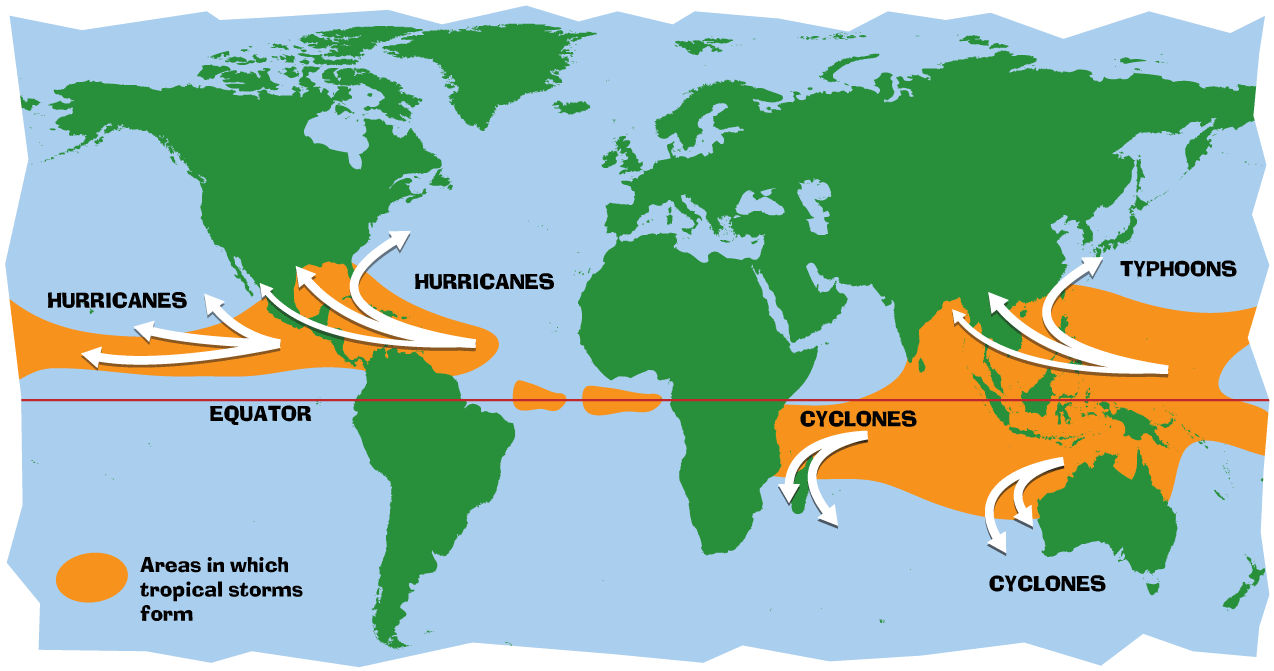
HURRICANES/CYCLONOES/TYPHOONS: Use a green colored pencil or marker to color all of the coastline waters facing the risk of tropical storms (hurricanes, cyclones, typhoons).
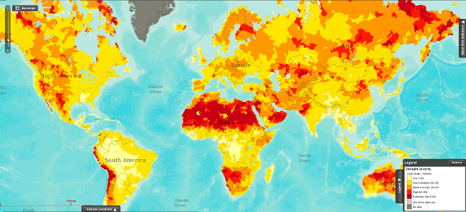
DROUGHT: Use a red colored pencil or marker to circle all of the areas where the severity/danger of drought is high or extremely high.
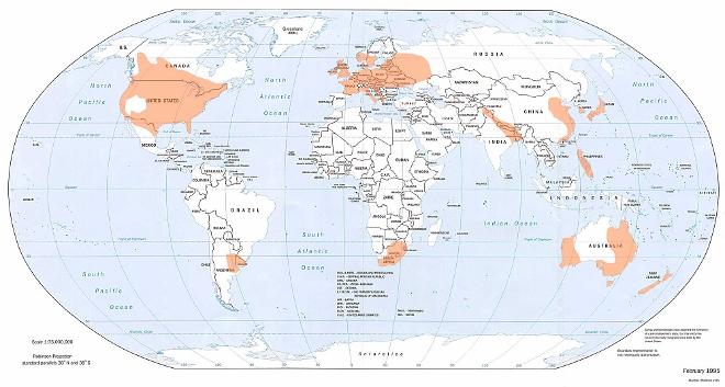
TORNADOES: Use a purple colored pencil or marker to draw vertical lines through all of the areas facing the threat of tornadoes.
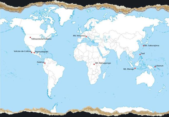
VOLCANOES: Use a black colored pencil or marker to mark X's in the location of the world's 10 most dangerous active volcanoes.